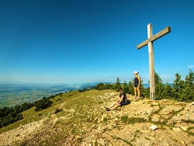
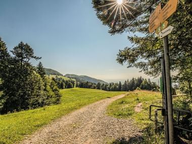
The Jura mountains spread in the form a gentle arc from Zurich to Geneva, from German-speaking Switzerland to French-speaking Switzerland. A beautiful, diverse mountain trail runs along their summits. The Regensberg-Nyon long-distance hike passes through quiet valleys, past rugged boulders, mysterious caves, several springs and lakes, through lonely forests and remote villages. In clear weather, hikers can enjoy a fantastic distant view of the Black Forest, the Vosges and the Alps.
Head for heights and surefootedness are beneficial for the hike through the Lägerngrat and can also be of help in the middle section of the Jura ridgeway trail. Basic fitness is a prerequisite for a long-distance hike.
The gentle warm-up is short-lived. The tough part starts soon after a stroll through the vineyards and a tour of the picturesque town of Regensberg which is located along an offshoot of the Jura: The ridge of the Lägern is rocky and a real rhythm breaker. It challenges hikers up to as far as the border of Baden.
The pretty town in Aargau along the banks of the Limmat invites hikers to linger and jump into the river for a refreshing swim. The more fearless Jura ridgeway hikers can indulge in another awe-inspiring river experience after this leg of the hike - over the “Gebenstorfer Horn” in Brugg. The river here is not Limmat, but Aare, where you can swim through the old stone “brugg”.

The hiking route passes through the old town of Brugg, then moves uphill towards Herzberg. You will now reach Jurapark, which offers various attractions. However, the Linner Linde has been standing here from long before Jurapark was founded. The tree is estimated to be 800 years old. The trunk circumference is an impressive 11 metres. You then continue to Staffelegg after watching the Schenkenberg ruins. This is where the passes start: Staffelegg is followed by Bänkerjoch, Salhöhe, Schafmatt and Untere Hauenstein.
The path across the Lower Hauenstein was already in use during the Roman period. There are wide cart paths around the area which also date back to that period and are admired by hikers. In this section, the Jura mountains are hilly and sometimes quite rugged, for example the Geissfluh at the border of Canton Basel-Landschaft. Buildings and coats of arms on the rock wall on the trail towards Belchenfluh are reminiscent of Swiss troops in the 1st and 2nd World War in this area. The view from Belchenfluh, a rugged peak that juts out from the trees, extends far beyond the midland up to the Alps. The route takes you through Roggen and its gentle meadows to the castle town of Balsthal. You can see castle ruins all around the small town between two Jura ranges.
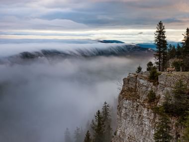
From Balsthal, there is a steep ascent to Weissenstein above Solothurn. A popular panoramic mountain even in winters if you stand high above the sea of fog. The view extends over the midlands to the Alps and from Säntis in the east to Mont Blanc in the south.
After that you start with the Planetenweg (Planetary Path) towards the language border. French is spoken starting from Montagne de Romont. Biel, in whose surroundings hikers of this tour pass the night, is bilingual. On the next day, the climb up to Chasseral, one of the highest peaks of the Swiss Jura, is not very difficult but it is very long. But the efforts of hikers are rewarded with a fantastic panoramic view: sparkling midland lakes at their feet and the Alps greeting them from a distance.
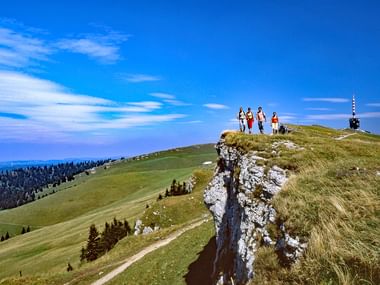
The trail now takes you through diverse landscapes between the St. Imier Valley and Val de Ruz and soon reaches the top of the pass Vue des Alpes at 1283 metres above sea level. The route that follows is like a dance on top of the Jura: the mountain range with its peaks Tête de Ran and Mont Racine is one of the highest elevations of the Jura mountains, the view of Lake Neuchâtel down under is sensational.
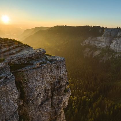
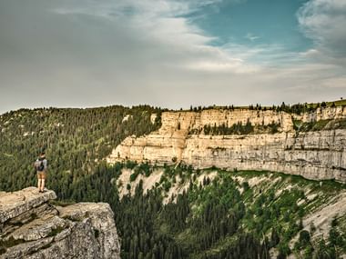
But every “flight” comes to an end. Here too, the path suddenly takes a steep descent through dense forests to reach Noiraigue in Val de Travers, the “transverse valley”. Not just the name Noiraigue but also its meaning is mysterious: why is this place called “black water”? After the mystical, silent place of the black water, you reach the Areuse gorge, through which the Areuse gushes loudly and thunderously. Finally, the trail leaves valley floors and gorges and winds up to the highlight of the region, the rock arena Creux du Van. This is a huge rock basin whose steep walls drop vertically down to the depths.
In the last one-third part of the Jura ridgeway hike, the landscape opens up and becomes even more lovely. The vineyards in the Three-Lakes region and again near Lake Geneva shine green or even golden in autumn. The trail draws closer and closer to the snow-capped Alpine peaks. But before you reach Lake Geneva, the trail passes through vast pastures in the Jura mountains at Ste Croix, the music boxes of Eldorado not far from the French border. Here in the Vaud Jura, you will find some old smugglers’ trails and countless exciting stories that could be narrated about these trails. The caves of Vallorbe, which are located at the source of the Orbe, are also legendary.
Just a little higher and also near the French border, you will see the high valley Vallée de Joux with the elongated Lac de Joux. It is home to many luxury watch brands. Due to its altitude of 1000 metres above sea level, the lake is considered to be a mountain lake and is also very cool. But hikers soon work up a sweat: the ascent to Mont Tendre, the highest elevation of the Swiss Jura, is strenuous. But the hikers’ efforts don’t go unrewarded; with good visibility, it is possible to see Lake Geneva, the Alps and even the Vosges with the Petit and Grand Ballon.

The hike finally approaches Lake Geneva. A park-like landscape, in which chalets are located in the meadows as if scattered by a large hand, is a pleasant sight. The pretty town of Saint Cergue is located in the heart of Parc Jura Vaudois. The ruins of an ancient monastery nearby look mystical and mysterious. The summit of La Dôle stands tall over the forests and meadows of the nature park. With an altitude of 1677 metres, it is just two metres shorter than Mont Tendre, the highest mountain in the Jura. The panoramic view, however, is as beautiful. Finally, the trail takes you through forests and vines not far from the border into the pretty little town of Nyon on Lake Geneva.
