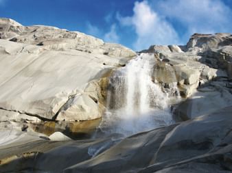
Itinerary
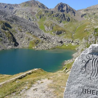
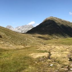
Baggage drop-off in Andermatt and by train up to the Oberalppass. From Oberalppass a steep climb leads to the source of the Rhine at the Tomasee lake. After hiking through the wetlands of Val Maighels you start the climb to the Maighelspass and the idyllic Portgerensee lake. This is followed by the descent to the Vermigel Hut.
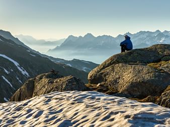
The trail climbs steeply up to Alp Summermatten, to the Sellapass and on to the highest point of the Four Springs Trail, the Piz Giübin (2'776 m), from where you can marvel at the panoramic view. The descent leads to the dam at the Sellasee lake and on to the Gotthardpass.
The route leads along the Lago Lucendro lake to the source of the Reuss at the foot of the Lucendropass and on over the pass. After a long and scenic high-level hike above the Bedrettotal valley, you reach your destination – the Piansecco Hut.
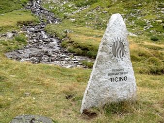
The route leads to the source area of the River Ticino below the Nufenenpass, home to many marmots. It then continues over the Nufenenpass, crossing magnificent Alpine meadows through the Ägenetal valley, over a hanging bridge and finally along the Rhone to the village Obergesteln.
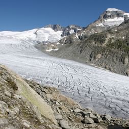
By public transport from Obergesteln to Gletsch or Belvédère. Todays stage brings you up to the Furkapass with stunning views of the Valais‘ 4000-meter mountains. The route then leads down via Alp Galen to a scenic vantage point above the Rhône Glacier source of the Rhone. You continue your hike towards Tiefenbach.
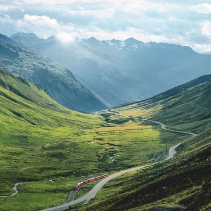
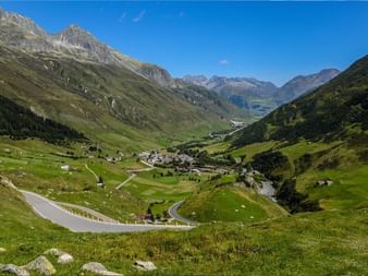
Pleasant hike on Urschnen high-level trail along stony south-eastern slopes above Urserental. Views down to Realp and Hospental, pass road and historic Furka steam railway. En route: tiny lakes, Alpine flowers, mountain streams and jagged cliffs. After arrival in Andermatt, individual departure.
Tour character
You need good physical condition, surefootedness and a good stamina for this alpine hike. It leads over passes and suspension bridges. Some demanding and long descends. The long stage of the 5th day you can shorten by using the Matterhorn-Gotthard train (MGB).
Prices & dates
Category: middle class hotels, Hospice on the Gotthard Pass, mountain inn with shower/toilet on the corridor in Tiefenbach, 2 x dormitories in SAC-mountain huts
Services & Information
Included:
- Accommodation as mentioned incl. breakfast
- 2x half-board in the SAC huts
- Daily Luggage transfers (apart from SAC-huts)
- Costs for luggage pick-up at the station (for direct arrival and departure)
- Subsidy for arrival by train
- Carefully elaborated route description
- Travel documents (1 x per room)
- Navigation app and GPS data available
- Switzerland Mobility-Plus subscription for one year
- Service Hotline
Note:
- Optional journey by public transport on day 5 from Obergesteln to Gletsch or Belvédère not included in the price (CHF 12.-)
- If the Vermigel Hut is fully booked, the Maighels Hut can be booked as an alternative. The price of the trip remains the same, but the second day is much more demanding (19.5 km, ↑ 1'110 m, ↓ 1'330 m)
- Tourist tax, if due, is not included in the price
- Reservation fee of CHF 20.- per adult (incl. legally required customer money protection)
Arrival/Departure:
- Arrival by public transport to Andermatt. If you arrive directly, hand in your luggage at the luggage counter by 10 a.m. at the latest.
- Departure by public transport from Andermatt. In case of direct departure, luggage must be returned to the luggage counter by 4 p.m. at the latest.
Arrival by train
Leave the car at home! For every bike, biking or hiking tour in Switzerland, you will receive an SBB coupon per participant, which you can use to deduct CHF 10.- from the ticket price for traveling by train. The reduction can be obtained in the SBB online store or in the SBB app.
On many trips, we use the luggage counters at the stations at the beginning and at the end to hand over the suitcases. You can conveniently combine this right away when you arrive by train. If you are a GA owner, you can provide this information when booking. We will credit you the amount on the invoice. If you don't need the coupon for the trip itself, you can use it during the year. Unfortunately, a retroactive refund is not possible for administrative reasons.
Travel documents "digital"
We reduce the amount of printed documents. You will receive instructions to help you find your way around using the Eurotrek Travel Guide App. We provide you with further information online.
In advance you will receive a small package of documents with the following contents:
- Your travel program
- Luggage tags
- Description of how to use the app
- Any vouchers
The Eurotrek Travel Guide App will help you find your way around. In addition to your digital map, you will find further information about your booked trip. The app is also available offline, simply download the trip in advance.
Services & Information
Included:
- Accommodation as mentioned incl. breakfast
- 2x half-board in the SAC huts
- Daily luggage transfer (1 piece of luggage per person, max. 20 kg), apart from SAC-huts
- Costs for luggage pick-up at the station (for direct arrival and departure)
- Subsidy for arrival by train
- Carefully elaborated route description
- Digital travel documents incl. navigation app
- Switzerland Mobility-Plus subscription for one year
- Service Hotline
Note:
- If the Vermigel Hut is fully booked, the Maighels Hut can be booked as an alternative. The price of the trip remains the same, but the second day is much more demanding (19.5 km, ↑ 1'110 m, ↓ 1'330 m)
- Optional journey by public transport on day 5 from Obergesteln to Gletsch or Belvédère not included in the price (CHF 12.-)
- Tourist tax, if due, is not included in the price
- Reservation fee of CHF 20.- per adult (incl. legally required customer money protection)
Arrival/Departure:
- Arrival by public transport to Andermatt. If you arrive directly, hand in your luggage at the luggage counter by 10 a.m. at the latest.
- Departure by public transport from Andermatt. In case of direct departure, luggage must be returned to the luggage counter by 4 p.m. at the latest.
Arrival by train
Leave the car at home! For every bike, biking or hiking tour in Switzerland, you will receive an SBB coupon per participant, which you can use to deduct CHF 10.- from the ticket price for traveling by train. The reduction can be obtained in the SBB online store or in the SBB app.
On many trips, we use the luggage counters at the stations at the beginning and at the end to hand over the suitcases. You can conveniently combine this right away when you arrive by train. If you are a GA owner, you can provide this information when booking. We will credit you the amount on the invoice. If you don't need the coupon for the trip itself, you can use it during the year. Unfortunately, a retroactive refund is not possible for administrative reasons.
Travel documents "digital"
We reduce the amount of printed documents. You will receive instructions to help you find your way around using the Eurotrek Travel Guide App. We provide you with further information online.
In advance you will receive a small package of documents with the following contents:
- Your travel program
- Luggage tags
- Description of how to use the app
- Any vouchers
The Eurotrek Travel Guide App will help you find your way around. In addition to your digital map, you will find further information about your booked trip. The app is also available offline, simply download the trip in advance.

