
Itinerary
Arrival to Maloja
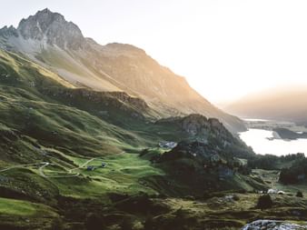
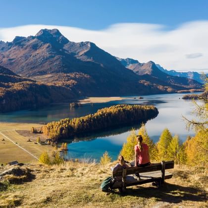
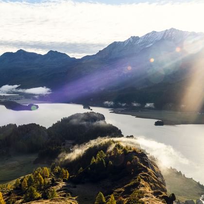
After starting in Maloja, you soon reach Heididorf (Heidi’s village) called Grevasalvas. Just before you reach the bottom of the valley at Sils, the trail takes you past Silvaplana to St. Moritz with a constant breathtaking view over the lakes in the Upper Engadine.
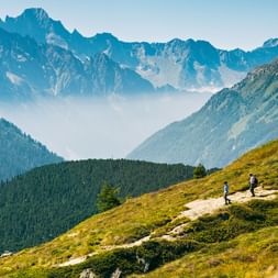
High above St. Moritz, the mountain path continues along Piz Padella and reaches Alp Muntatsch. After taking a break, you can walk to the original village of Samedan, which is pretty close by. Val Bever is just a stone's throw away from here.
Along Via Engiadina and uphill to Crast Mora. Enjoy the view of the valley floor and the nearby peaks of the Bernina range. The tour takes you over stone stairs and forest roads to a plateau. You will cross a stream above the Val Müra gorge and descend into Zuoz.
By bus or rail to S-chanf. From here, the tour will take you through the Swiss National Park, across lush alpine meadows to Val Trupchun, one of the idyllic side valleys of the Upper Engadine. This versatile route gives a glimpse of the unique flora and fauna of this region.
Walking at a low altitude along the valley floor of the Upper Engadine. The hike leads you through pine and larch forests and past idyllic Engadine villages. You will climb up to the Acla Laret and pass Chapella.
You will then cross the Punt Ota brook, which forms the border between Lower and Upper Engadine, and then proceed to walk through fragrant mountain meadows down to Zernez. After arrival in Zernez individual departure.
Tour character
A promising high-altitude hike for connoisseurs. Ascents and descents cannot be avoided for reaching the stage destinations. Good basic physical fitness is therefore required. Mountain hiking trails in the Engadine require surefootedness.
Find more information about the region here.
The Via Engiadina in the region Engadin St. Moritz
Prices & dates
Category: middle class hotels, 4* hotel in Bever


Services & Information
Included:
- Accommodation as mentioned incl. breakfast
- Daily luggage transfer
- Costs for luggage pick-up at the station (for direct departure)
- Subsidy for arrival by train
- Carefully elaborated route description
- Travel documents (1 x per room)
- Navigation app and GPS data available
- SwitzerlandMobility-Plus subscription for one year
- Service hotline
Note:
- Tourist tax, if due, is not included in the price
- Reservation fee of CHF 20.- per adult (incl. legally required customer money protection)
Arrival/Departure:
- Arrival by public transport to Maloja.
- Departure by public transport from Zernez. In case of direct departure: Luggage will be returned to the luggage counter by 5:00 p.m. at the latest.
Arrival by train:
Leave the car at home! For every bike, biking or hiking tour in Switzerland, you will receive an SBB coupon per participant, which you can use to deduct CHF 10 from the ticket price for traveling by train. The reduction can be obtained in the SBB online store or in the SBB app.
On many trips, we use the luggage counters at the stations at the beginning and at the end to hand over the suitcases. You can conveniently combine this right away when you arrive by train. If you are a GA owner, you can provide this information when booking. We will credit you the amount on the invoice. If you don't need the coupon for the trip itself, you can use it during the year. Unfortunately, a retroactive refund is not possible for administrative reasons.
Travel documents "digital"
We reduce the amount of printed documents. You will receive instructions to help you find your way around using the Eurotrek Travel Guide App. We provide you with further information online.
In advance you will receive a small package of documents with the following contents:
- Your travel program
- Luggage tags
- Description of how to use the app
- Any vouchers
The Eurotrek Travel Guide App will help you find your way around. In addition to your digital map, you will find further information about your booked trip. The app is also available offline, simply download the trip in advance.
Services & Information
Included:
- Accommodation as mentioned incl. breakfast
- Daily luggage transfer (1 piece of luggage per person, max. 20 kg)
- Costs for luggage pick-up at the station (for direct departure)
- Subsidy for arrival by train
- Carefully elaborated route description
- Digital travel documents incl. navigation app
- SwitzerlandMobility-Plus subscription for one year
- Service hotline
Note:
- Tourist tax, if due, is not included in the price
- Reservation fee of CHF 20.- per adult (incl. legally required customer money protection)
Arrival/Departure:
- Arrival by public transport to Maloja.
- Departure by public transport from Zernez. In case of direct departure: Luggage will be returned to the luggage counter by 5:00 p.m. at the latest.
Arrival by train:
Leave the car at home! For every bike, biking or hiking tour in Switzerland, you will receive an SBB coupon per participant, which you can use to deduct CHF 10 from the ticket price for traveling by train. The reduction can be obtained in the SBB online store or in the SBB app.
On many trips, we use the luggage counters at the stations at the beginning and at the end to hand over the suitcases. You can conveniently combine this right away when you arrive by train. If you are a GA owner, you can provide this information when booking. We will credit you the amount on the invoice. If you don't need the coupon for the trip itself, you can use it during the year. Unfortunately, a retroactive refund is not possible for administrative reasons.
Travel documents "digital"
We reduce the amount of printed documents. You will receive instructions to help you find your way around using the Eurotrek Travel Guide App. We provide you with further information online.
In advance you will receive a small package of documents with the following contents:
- Your travel program
- Luggage tags
- Description of how to use the app
- Any vouchers
The Eurotrek Travel Guide App will help you find your way around. In addition to your digital map, you will find further information about your booked trip. The app is also available offline, simply download the trip in advance.


